Researching raw land before you buy
Last checked
A cheap piece of land is easy to fall for and hard to build on. The price rarely reflects the work it takes to make land usable. You need a road, water, a way to handle sewage, and permission to build what you want. Here are the questions to answer first, roughly in the order they end deals.
Can I build what I want here?
Zoning decides that. Call the county planning department with the parcel number and ask three things. Is this a legal lot that can be built on? What does the zoning allow? Are there any open violations on it? Ventura County, California, tells land buyers to ask exactly that, and the questions work anywhere.
“Legal lot” is its own question. A parcel can be zoned for a house and still not be a lot the county will issue a building permit for. Then ask about the rules for the building itself. Kitsap County, Washington, points buyers to setbacks from the property lines, height limits and how much of the lot a building may cover.
Can I legally get to it?
A dirt track to the parcel isn’t the same as a right to use it. If the only way in crosses a neighbor’s land, you need a recorded right to cross, usually called an easement. The title report should show it. If it doesn’t, a survey and a real estate attorney are cheaper than finding out later.
Where will water come from?
Without a city water line, it’s a well. The EPA says private wells aren’t covered by the federal Safe Drinking Water Act, and most states don’t regulate them either. The owner is responsible for the water being safe. Ask neighbors how deep their wells are and how much they produce, and test any existing well before you buy.
Where will the sewage go?
Without a sewer line, it’s a septic system, and not every piece of ground can take one. Just over 1 in 5 American homes uses septic, by the EPA’s 2026 count.
Before you buy, ask the county health department whether septic is possible on the lot, and get a soil test, often called a perc test. A soils engineer digs test holes and measures how fast water drains away. A failed test can mean no ordinary septic system, and the alternatives are expensive or not allowed at all.
Who owns what’s underneath?
In parts of the West, buying the surface doesn’t get you the minerals below it. The Bureau of Land Management calls this a split estate. In some areas the federal government kept the mineral rights when the land was first given out. Whoever holds them may be allowed to use part of the surface to get at them. Check the title, and in the West, ask the BLM.
Will it flood, or burn?
Building in a FEMA flood zone comes with rules. Towns in the federal flood program must require a permit. In the main high-risk zones, the ones FEMA labels A, a new home’s lowest floor has to sit at or above the expected flood level. Communities can set stricter rules. That can add a lot to the cost of building. Look up the parcel on FEMA’s own flood map.
Wildfire risk changes fast over short distances, between a canyon and the ridge above it. Our guide to why wildfire maps disagree shows how sharply it can change from one neighborhood to the next.
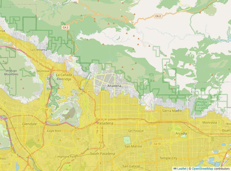
The bare foothills above Altadena aren’t shaded for a different reason: nobody lives there, so the map doesn’t measure them. Which brings us to land.
What can our map tell me about land?
Less than about a house. Our layers shade built-up land, so a bare parcel shows no color on any of them. That isn’t a clean bill of health. It means the parcel itself isn’t measured. For the parcel, use FEMA’s flood map and the county’s own maps.
What the map does show is the life around it. The hospital layer shows how far care would be. The property tax layer shows how heavy taxes run in the nearest built-up areas. Our guide to lower disaster risk covers the hazard layers.
A short checklist
- Planning department: legal lot, zoning, setbacks, open violations.
- Title report and, ideally, a survey: recorded legal access.
- Health department: septic possible, and a soil test.
- Water: an existing well tested, or a realistic plan for one.
- FEMA flood map for the parcel, and a quote for insuring what you’d build.
- In the West: who owns the minerals.
If you want to see what’s around a parcel, open the map with hospitals and property tax on.