Almaden Valley, San Jose: a neighborhood report
Last checked
ZIP code 95120 covers about 39 square miles. The part most people mean by Almaden Valley is the valley floor at San José’s southern end, between the Santa Teresa Hills and the ridges of the Sierra Azul. Almaden Expressway runs down the middle. About two-thirds of the ZIP’s land is hills and parkland outside city limits, including the historic village of New Almaden.
On the map: where the wildfire risk starts
The valley floor is outside the state’s fire hazard zones. The hillside edges are not. The city’s 2025 map puts High and Moderate zones along the hills. The state’s map for the unincorporated hills, in effect since 2024, adds a Very High zone and rates New Almaden village High.
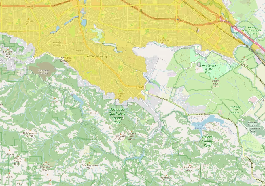
The picture uses a different measure, the U.S. Forest Service’s rating of wildfire risk to homes, so its lines are close to the state maps but not the same. Either way, the boundary matters for insurance as well as safety. Our guide to finding a home you can still insure covers what to check before an offer.
Hillsides, soil and faults
The hills that frame the valley also move. The southern and eastern hill edges fall largely in state earthquake-induced landslide zones. Inside one, the city requires a geologic hazard clearance, which can mean a soils study and repairs, before it issues a permit. On the valley floor the soil swells and shrinks only moderately.
The Monte Vista–Shannon fault zone runs within about a mile of the middle of the valley. It isn’t one of the faults zoned under state law. The San Andreas fault is about 7.5 miles away. Mapped sections of the Hayward and Calaveras fault zones lie about 8 to 11 miles to the east.
Most of the valley floor is in FEMA Zone D, where flood risk hasn’t been studied, and narrow high-risk strips follow the creeks. In January 1995, Calero Creek overflowed at McKean Road.
Mercury, and why the lake is for looking at
New Almaden is one of California’s oldest mines. Mercury ore was identified here in 1845, before the Gold Rush, and mining went on, with long gaps, into the 1970s. The mercury is still in the water. The state advises eating no fish from Almaden Lake, the Almaden, Calero and Guadalupe reservoirs, or the nearby creeks. As of 2026, Almaden Lake Park allows no swimming or boating. A Valley Water project to reroute the creek around the lake was postponed in 2023.
A short history
The mine manager’s house, Casa Grande, was built in 1854 and now holds a mining museum. Santa Clara County bought the mine hills for a park in the mid-1970s. New Almaden is a National Historic Landmark district with its own county zoning. The valley floor was annexed to San José piece by piece, mostly in the 1960s, and built out over the next three decades.
The houses, and what’s being built
Most of the valley was built within 30 years. In ZIP code 95120 the median home dates from 1976, and more than eight in ten were built between 1960 and 1989. Nearly nine in ten are detached single-family houses. Homes in New Almaden fall under the county’s historic district rules.
San José’s citywide rules on backyard cottages and lot splits apply here too. There are pre-approved ADU plans, up to four homes on a single-family lot under SB 9, and since July 2026, denser housing near qualifying transit stops under SB 79. New building is small-scale. In 2024 a developer filed plans for 49 homes at 19780 Almaden Road under the state’s “builder’s remedy” rules, which bypass local zoning.
Shopping
Errands are close. A Safeway sits a few blocks from Camden Avenue and Almaden Expressway. The Almaden Ranch center, opened in 2016 with a Bass Pro Shops, is a short drive north. A Costco, a Walmart Supercenter and a Target are each about 3 miles away. Westfield Oakridge, the nearest large mall, is about 3.3 miles.
What locals do for fun
Almaden Quicksilver County Park covers 4,163 acres of the ridge west of the valley. It has more than 37 miles of trails, 30 of them open to horses and 16.6 to bikes, and it’s free from 8 a.m. to sunset. The mining museum in Casa Grande opens on varying hours, so call ahead. Almaden Lake Park has playgrounds, bocce and an amphitheater, and the Los Alamitos, Calero and Guadalupe creek trails run the length of the valley. Calero County Park lies to the southeast.
Downtown San José and SAP Center are about 10 miles north, and the Santa Cruz Boardwalk about 45 minutes over the hill.
Getting around
Almaden Expressway connects to Highways 85 and 87, and Blossom Hill Road is the main east-west road. VTA’s light rail branch to the valley was replaced by buses in 2019. The nearest light rail station, Ohlone/Chynoweth on the Blue Line, is about 3.6 miles by road. Diridon station is about 9.6 miles and San José’s airport about 12.6.
Services, taxes and climate
- City or county: check which side of the city line an address is on. It decides who provides services, which fire map applies, and who approves a remodel.
- Water: both San Jose Water and Great Oaks Water serve parts of the valley; check the address.
- Electricity, inside the city: San José Clean Energy supplies it by default and PG&E delivers it.
- Hospitals: Kaiser San José and Good Samaritan are each about 7 miles, roughly 12 minutes by car.
- Schools: most of the area is in the San José Unified School District. Check the district’s boundary tool for an address.
- Property tax: California’s base rate is 1% of assessed value plus voter-approved local charges. Assessed value can rise at most 2% a year until a sale.
Facts on this page were checked against city, county, state and federal sources on October 31, 2026.
Explore it yourself
Open the map over Almaden Valley with wildfire, flood and parks switched on, then add what matters to you.